
Cloonagh [Carroward]
Good walks are even better shared.
Overview
Cloonagh [Carroward]
Nestled in the beautiful County Mayo, Cloonagh [Carroward] is a gem in the West of Ireland, beloved by local hikers and visitors alike. Standing tall at 447 meters, it may not be the highest peak, but what it lacks in height it makes up for with stunning views and rewarding hiking experiences.
Geology
The mountain's robust geology consists mainly of schist and granite, providing a strong base for its rocky formations. The natural sculpting by glacial movements has revealed fascinating rock outcrops, which will leave geology buffs breathless, in more ways than one!
Routes
A popular choice for climbers is the Knocknarea Circuit, which begins in the quaint village of Carrowtigue. This moderate path spans approximately 8 km and takes around 3.5 hours to complete. Expect to encounter sweeping vistas and delightful flora as you ascend.
Summit Features
The summit features a charming cairn, built by fellow walkers, serving as a sturdy marker for achievement. The panoramic views, especially on a clear day, ensure that you'll feel on top of the world—and not just figuratively.
Terrain
Be prepared for a mix of grassy slopes and rocky outcrops, with the occasional boggy patch to test your stamina. It's a landscape that offers challenges and beauty in equal measure, so don’t forget your sturdy hiking boots!
Views
The views from Cloonagh are nothing short of spectacular. The surrounding peaks, particularly Nephin to the north, create a breathtaking backdrop, while the Atlantic waves crash against the coast to the west. Spring and autumn are the best seasons to go; the skies tend to be clearer and the colours more vibrant.
Hazards
As with any hike in the Irish wilderness, weather changes can be rapid and unpredictable. The terrain can also become slick after rain, so be prepared and keep a lookout for the resident sheep who sometimes take their own sweet time crossing your path.
Access
Accessing Cloonagh is easy! There’s parking available in Carrowtigue village, and Westport is a mere 16 km away if you fancy a spot of town life before or after your hike. Regional bus services can drop you at Carrowtigue, though they may be sporadic, so do plan ahead.
Facilities
After your adventure, Westport offers a bounty of cafes and restaurants to fuel up on treats. Grab a well-deserved cup of tea and maybe a slice of cake—after all, you’ve earned it!
History
Cloonagh’s name comes from the Irish word 'Cluain,' meaning meadow. The area boasts a rich history with ancient burial sites nearby, weaving together nature and legend in a lovely tapestry of history.
In summary, Cloonagh [Carroward] is perfect for both seasoned hikers and those just wanting to stretch their legs and capture some breathtaking views. Remember to pack a sense of adventure—and perhaps a sandwich or two. Enjoy the journey!
Explore routes near Cloonagh [Carroward]
Public walks starting within 80 km of this hill. Nearby does not mean a route reaches the summit; check its map and access before setting out.
Route planning notes
These notes describe possible approaches, not verified navigable routes or permission to cross land. Check current paths, local access rules and conditions before setting out.
Knocknarea Circuit
A scenic route that starts from the village of Carrowtigue, leading along a well-marked path up to Cloonagh. The route offers delightful views and a chance to enjoy the local flora.
Make a day of it, together
Find someone to share the walk with, or organise a day out along a route you like.
Hill facts and local notes
Classifications
Elevation
349m
1,145 ft
Prominence
102m
Coordinates
54.1909, -8.6901
G550271
OS Map
25
At the Summit
The summit is crowned with a modest cairn, thoughtfully constructed by fellow hikers who perhaps had a moment of clarity on the way up. On a clear day, the views are equally stimulating.
Terrain & Geology
Cloonagh [Carroward] is primarily composed of schist and granite, providing a robust foundation to its rugged formations. The area exhibits classic glacial features, including a variety of striking rock outcrops.
Views & Scenery
From the summit, gaze upon the surrounding mountains, including Nephin to the north and the lapping waves of the Atlantic to the west. If you squint just right, maybe you’ll even spot a puffin or two.
History & Heritage
Name Origin
The name Cloonagh is derived from the Irish 'Cluain' meaning 'meadow', while 'Carroward' refers to its positioning as a promontory.
Historical Significance
The area has historical significance, with ancient burial sites and local legends entwining the landscape, offering a rich tapestry of stories for those interested in the mythology of Ireland.
Getting There & Facilities
Check current local access restrictions, parking rules and transport timetables before travelling. These notes do not confirm public access to the summit.
Parking
There is a small parking area in Carrowtigue village, which is the ideal jumping-off point for ascending Cloonagh.
Public Transport
Buses from Castlebar can drop you off at Carrowtigue, but services are limited, so double-check the timetable to avoid being left high and dry.
Nearby Facilities
In Westport, you'll find plenty of cafes, restaurants, and toilet facilities to freshen up after your hike. There's nothing quite like a good cup of tea after a long trek!
Safety Information
Known Hazards
- Beware of sudden weather changes common in the region. The terrain may also be slick and uneven, particularly after rain. Always keep an eye out for wandering sheep!
General Safety Tips
- Check weather conditions before setting out
- Carry appropriate clothing and equipment
- Let someone know your planned route
- Take a map, compass, and GPS device
- Carry emergency supplies: food, water, first aid kit, torch
Hills
Some common questions about the hills answered
Are there group walks up Cloonagh [Carroward]?
Many walkers use Walkmates to join or organise walks with others. You can check for group walks around Cloonagh [Carroward] through the maps
Are there other walkers around Cloonagh [Carroward]?
Activity varies by location and time, but Walkmates lets you see whether others have shared walks or shown interest in this area. Find other people through the walking friends search walking friends for Cloonagh [Carroward] search or of course create your own walk for Cloonagh [Carroward]
Can I organise a walk to Cloonagh [Carroward]?
Yes. If there aren’t any walks listed already, you can create a walk and make it available for others to join.
If you're signed up to Walkmates, you can create a walk to Cloonagh [Carroward].
How do I find a walk up this hill?
There are often multiple ways to walk this hill, depending on experience and route preference. Walkmates helps you explore walks and routes that others have shared.
Can I suggest a new route up Cloonagh [Carroward]?
Yes. You can suggest or create routes to share with others. Walkmates focuses on the social side of walking, so routes are used to help people organise walks and explore areas together, rather than as detailed navigation tools or route libraries.
Other uses really appreciate knowledgeable walkers sharing their routes. Share your favourite route to Cloonagh [Carroward] here
The is an error or something incorrect about this hill. How do I let you know?
We always strive to keep the information on Walkmates as accurate as possible. If you find an error, please let us know through the contact form and we'll aim to correct it as quickly as possible
Community Discussion
Comments
Location
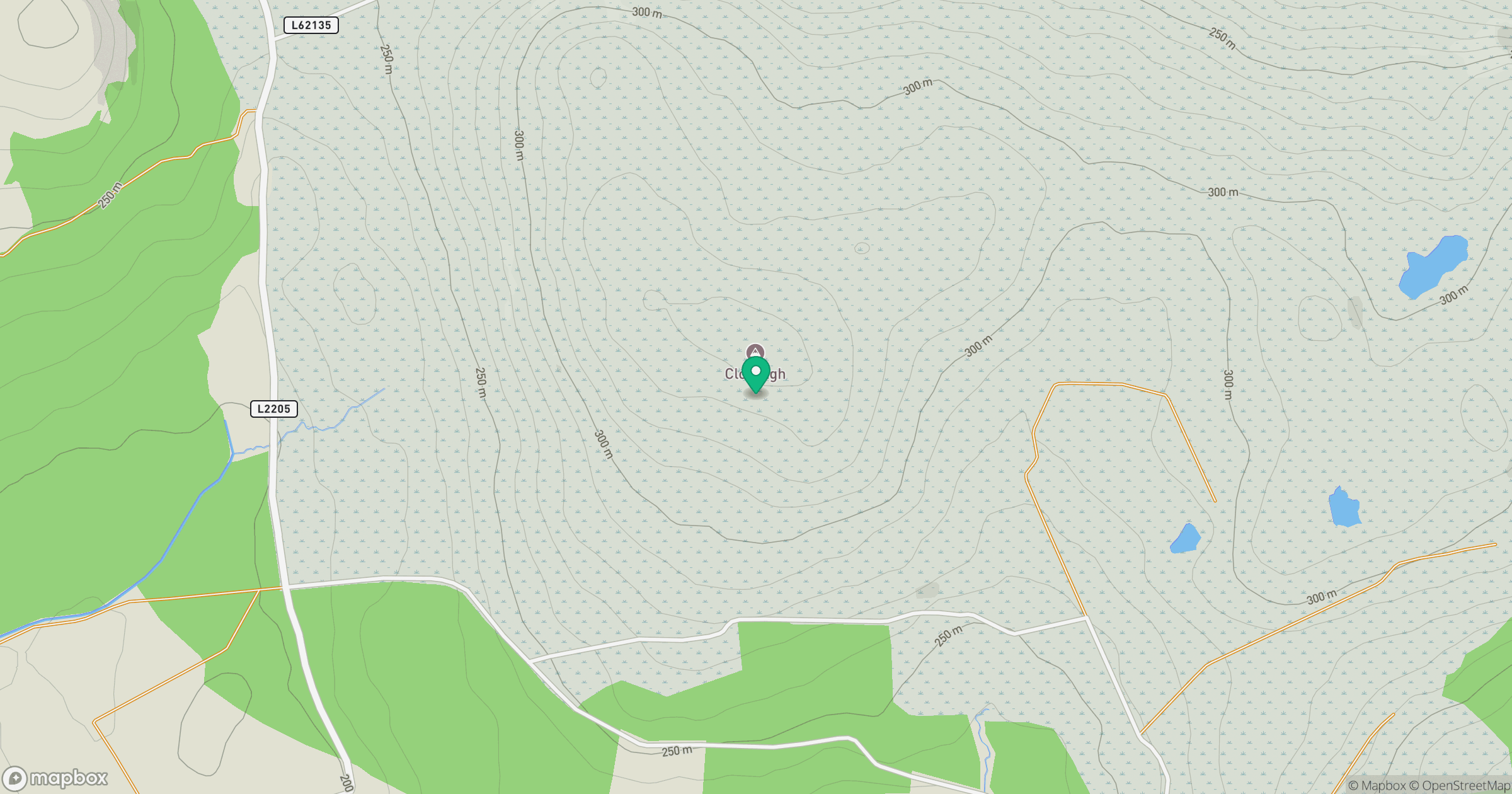
Grid reference: G550271
View on OpenStreetMapOpens a map in a new tab, centred on the hill.
Hills within 30 km
Straight-line distance, not a walking route or confirmation of access.
No comments yet. Be the first.